MetroParks is the first and only Ohio park system to participate in Google's Street View Trekker program.
The local parks system partnered with the Kettering-based Outdoor Adventure Connection and the 3,000-member Dayton Hikers group for the project that is creating 360-degree interactive views of Dayton-area trails for Google.
"Here in Dayton, we are the outdoor adventure capital of the Midwest," Outdoor Adventure Connection's Andy Niekamp said. "This will allow people who otherwise would not visit Dayton to experience our hiking trails. "
Dayton was selected to host California-based American Trails' 2017 International Trails Symposium.
HOW DOES IT WORK?
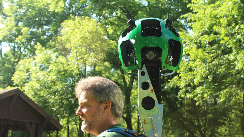
Outdoor Adventure Connection’s Andy Niekamp is pictured with Google's Street View Trekker device. (Photo by Amelia Robinson)
Controled by a smartphone, the 4-foot-high, GPS-equipped system has 15 cameras positioned in various directions. They take photos every two seconds to create panoramic street view-like "treks."
Niekamp said four experienced hikers from Dayton Hikers were trained to map hiking and horse trails by foot weekdays between 9 a.m. and 3 p.m.
MetroPark staffers using boats, cars, sports utility vehicles and kayaks will use the device to document the region's 300 miles of connected bike trails and river and lake trails. Picnic areas and other features also will be recorded for Google by Aug. 10.
WHEN CAN YOU USE IT?
The project will appear on Google Maps in 6 months to a year.
Most of the work will be done in Five Rivers MetroParks system.
"We want all the features of the Five Rivers MetroParks to be featured," Niekamp said.
Faces and license plate numbers will be blurred out by Google technology.
"This will help with trip planning and be a great asset to showcase Dayton, Ohio, as the Outdoor Adventure Capital of the Midwest," said Amy Dingle, director of outdoor connections for Five Rivers MetroParks.
Andy Niekamp is pictured with Google's Street View Trekker device. (Photo by Amelia Robinson)
Andy Niekamp is pictured with Google's Street View Trekker device. (Photo by Amelia Robinson)
About the Author