Original report
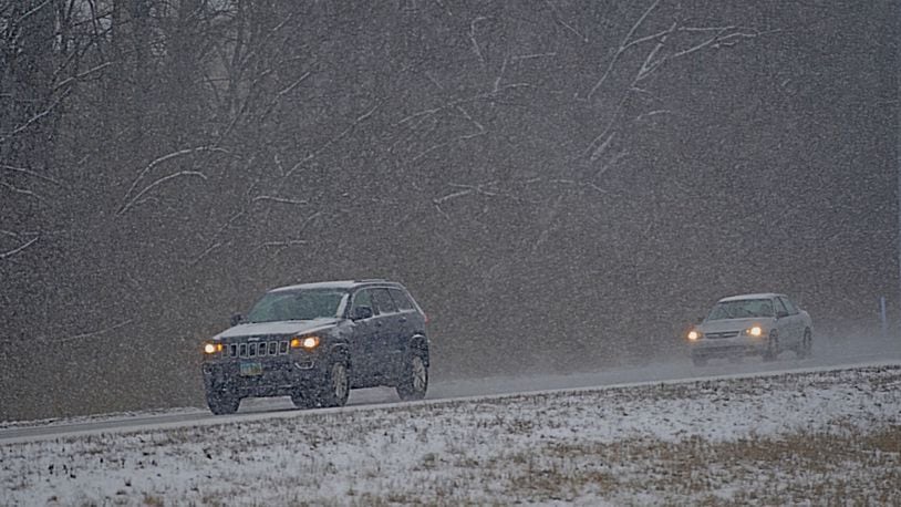
The Dayton, Springfield and Hamilton areas likely will be spared the big snowstorm expected to hit eastern Ohio today but there may be local snow showers on Monday, according to the National Weather Service in Wilmington.
Snow will begin this evening, with Montgomery County forecast to get anywhere from a trace of snow to an inch, said meteorologist Logan Clark. He said the Clark County area could get a little more and Butler County likely would get a little less between 6 p.m. and midnight today.
By comparison, he said the Scioto Valley to the east could get 5 to 8 inches of snow, as the weather system drops significantly more snow to the east and southeast of the U.S.
“Which goes to show how fine the line is between a trace to an inch and significant accumulations,” Clark said.
Sunday morning’s sunny weather will turn to clouds around noon and remain overcast for the rest of the day, with a high near 37 degrees. The low tonight will be about 24 degrees.
Clark said the fast-moving weather system will give way to one coming in from the Plains on Monday and that may bring scattered snow showers. Accumulations could be from a few tenths to an inch of snow, he said.
“While the forecast calls for a little accumulation, taking time to prepare can head off any problems if the storm worsens,” said Kara Hitchens, AAA Miami Valley spokesperson.
“AAA urges motorists to use the calm before the storm to prepare their vehicles by filling up their gas tanks and packing a vehicle emergency kit,” she said. “No one ever plans to get stuck. Preparation can make all the difference, as a typical 15-minute drive could take much longer, especially during the late afternoon and evening hours.”
The high Monday, Martin Luther King Day, will be 32 degrees with a 30 percent chance of precipitation that will increase as the day progresses.
“I think Clark County has a better chance of a larger section of the county getting measurable snowfall than Montgomery County,” Clark said. “I think Butler County is probably similar to Montgomery County, in that only part of the county would get measurable snow.”
[8:40 AM] One thing that's becoming clear -- there is likely to be a several hour window for tremendous snowfall rates late afternoon thru evening in NE KY thru cntrl OH. Rapid accum likely in highlighted areas, w/ roads becoming snow-covered. Travel to be hazardous this evening. pic.twitter.com/v1UXwYA0Hz
— NWS Wilmington OH (@NWSILN) January 16, 2022
This winter’s weather has been unusually mild, Clark said.
“We had a very abnormally warm December,” with several days in the 60′s and an average high of the low-40s, he said.
January has seen more below-average temperatures than usual but the lack of snow has been most notable.
“For the Dayton area since July 1 we’ve recorded 9/10ths of an inch of snow,” Clark said. “The normal would be 9.8 inches of snow.”
Follow @LynnHulseyDDN on Twitter and Facebook
About the Author