It is expected to start today with an approaching cold front that will bring rain and snow followed by increased chances of snow through the weekend and into next week, according to the National Weather Service in Wilmington.
The last time extremely cold air arrived in the region was in 2014. That brought actual temperatures of minus 15 degrees to minus 19 degrees for parts of the area. Wind chills plunged to as low as minus 49 in parts of the region.
Credit: National Weather Service
Credit: National Weather Service
What may be surprising is that spikes in temperatures is what causes the extreme cold with subfreezing temperatures and potentially dangerous wind chills.
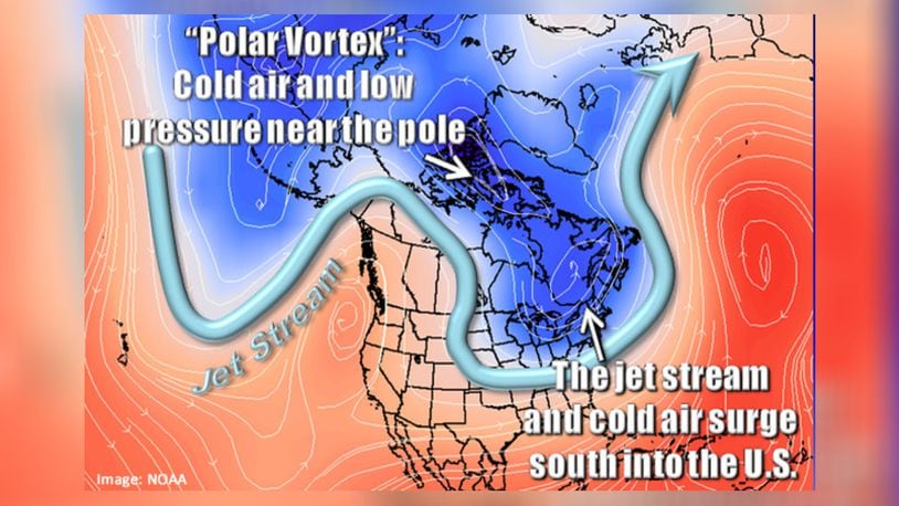
The polar vortex is a large area of low pressure and cold air that always exists, surrounding both of the Earth’s poles, the NWS said. It weakens in summer and strengthens in winter, but with some regularity can weaken during wintertime as well and escape into the jet stream.
However, meteorologists in early January recorded a major stratospheric warming that caused the polar vortex to drastically weaken and it is expected to split in two.
The worst of the cold weather is expected to remain above Ohio, according to the NWS.
Credit: NOAA
Credit: NOAA
People exposed to extreme cold can experience frostbite in a matter of minutes — especially on bare skin and hands and feet. Hypothermia is another threat, when the body loses heat faster than it can produce it.
Other past years a polar vortex brought subzero weather was in 1977, 1982, 1985 and 1989, according to the NWS.
About the Author